|
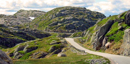
Route: The journey continues through fjords, small ferries, and modern bridges leading to Lysebotn.
Difficulty: Fully paved roads with mountain passes and high plateaus
Distance: 343 km |
 |
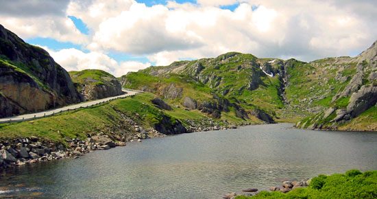 |
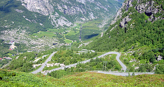
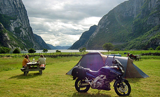
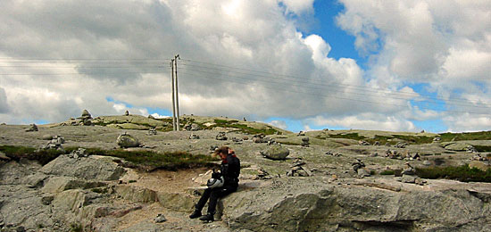
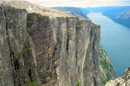
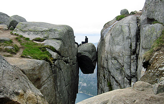
| A narrow side road winds its way over 31 km down to Lysebotn Fjord. Until late June, snow can still cover the higher sections up to 850 meters above sea level, although the road itself is usually clear. This stretch is both a riding and scenic highlight. The landscape is truly spectacular, and small stone cairns can be seen along the route. At the end of the road, a ferry connects Lysebotn with Forsand toward Stavanger for around 175 NOK (approximately €23). In Lysebotn itself, we set up camp at a campsite right by the fjord. The next day is reserved for hiking Kjerag, one of Norway’s most famous viewpoints. The Kjerag boulder is about 3 meters in diameter and sits roughly 1,000 meters above sea level. From the campsite, a serpentine road climbs up to a viewpoint at around 750 meters elevation. |
 |
 |
| The campsite lies directly on the fjord and offers good facilities for around 60 NOK (about €8) per night for two people, including motorcycle and tent. Amenities include clean sanitary buildings, a small kitchen, laundry machines, and seating areas. The location is truly idyllic. Hiking to Kjerag is an absolute must when visiting Norway. |
 |
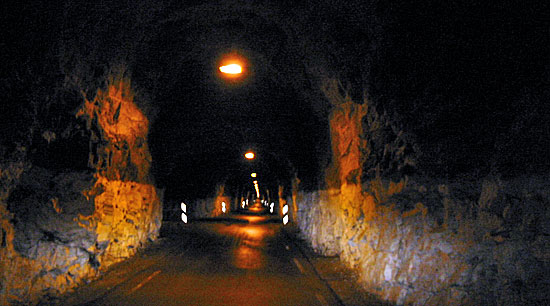
| After a short coffee break, the hike begins. The trail is marked with red T symbols. It starts with a steep 200-meter climb, followed by a descent into a valley, and then another 150-meter ascent. After a final climb, we reach the breathtaking viewpoint. From the top, there is an incredible view over Lysebotn and the campsite below. In some places, the drop is almost 1,000 meters straight down—so visitors may experience a slight sense of vertigo. Nevertheless, the view is unforgettable. On sunny days, the trail feels almost like a pilgrimage, with many hikers heading toward the same goal. On the way back, we descend the famous 27 hairpin bends and pass through a 1-kilometer-long one-way tunnel, which is quite an unusual driving experience. |
 |
 |
 |
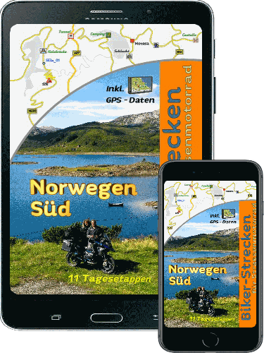
| Information: E-book (Available for Purchase) |
|

GPS Data: |