Travel Regions
 Albania
 Romania Offroad
 Slovenia
 Pyrenees Offroad
 Iceland Offroad
 Croatia
 Montenegro
 Morocco Offroad
 Tunisia
 Andalusia1 (Spain)
Map Offroad routes
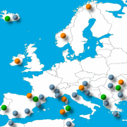 Overview Map for Offroad routes
here click
 |
Route: Pyrenees/Region Andorra-Espot
Particularity: Scenic Route
Route length: 30 KM
|
|
Driven the track with a TGB 550 (ATV - Quad) and with a KTM 950SE (2 Persons) |
||||
 |
|
Route description This route leads to the summit, from where you have the best view in the Pyrenees. |
 |
 |
|
|
|
The panoramic view all around is awesome, the clouds are close, it is a place that you will not soon Forget! |

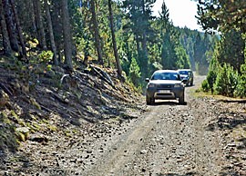 |
You are here not alone, that´s the terrain for Enduro bikes and 4x4 cars. |
|
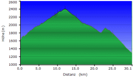
Where:
Cataluna/Andorra Route length:
ca. 30 KM Difficulty: Gravel track Max Hight:
2390 Meter |
 |
|
|
 |

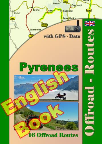
Onlineshop EN Tourbook Pyrenees Offroad
|
|
Offroad Routes through Pyrenees
|
|
|
GPS-Data CD As an option, there is a CD with the GPS routes and the most important points as accommodations (camping), gas stations and tourist sites as POI's on it |
|
|
USB flash drive (4 GB) However, the file contents of the USB stick is the same as on the data disc, the USB stick can be used again later. |
|
|
Micro-SD card (2GB) only for Garmin device The Micro-SD Card is only compatible for Garmin devices. She contents all the GPS data and the overlay routes. The card need only to be insert in a garmin device and you can drive on. click here |

Shop List
| 0 Products | - | 0.00 EUR |
| Go to cart | ||
Onlineshop (EN)

We have 458 guests and no members online
- Articles View Hits
- 20865242