|
Route description |
") |
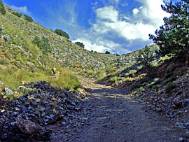
| We turn off a small paved road onto a gravel track that leads us to the lower mountains. The path becomes rougher and quickly climbs to about 1500 meters. Afterwards, we descend steeply and arrive in a small village nestled in a valley. |
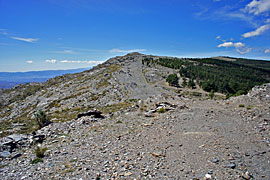  |
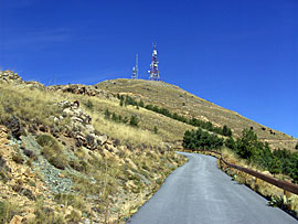
| The gravel road climbs again, and we drive along the ridge past a radar station until we reach a plateau. From there, a small paved road leads to a viewpoint called Tetica. The view from there is magnificent. |
  |
  |
") |
| We drive back along a stretch of paved road into the valley and then turn onto another gravel road. A ranger passes us here and asks if we're having any problems. After that, a small, winding track leads down into the valley, where we also pass a Serrano ham factory. |
") |
Tour reports Andalusia (overview)
- BA1 Altiplano Granadino (EN)
- BA2 Andalusia Off-road tour Reservoir
- BA3 Sierra Baza Off-road tours
- BA6 Andalusia Offroad 4x4
- BA7 Sierra Filabres Andalusia Enduro routes
- BA8 Tetica Round Andalusia
- BA10 Sierra Lucar Andalusia
- BA11 Sierra Corafe Canyon and Vultures
- BA12 Sierra de Huetor Andalusia
- BA14 Sierra Nevada Spain
- BA15 Plantation runway
- BA17 Confines de la Sierra Spain
- BA18 panoramic piste Andalusia
- BA19 Garzorla National Park, Andalusia
- BA21 Sierra Gigantes Andalusia Offroad
- BA22 Rambla Feeling Andalusia Offroad
- BA23 Western piste mini Hollywood
- BA24 Tabernas Runway Spain
| Info Bestellartikel (EBook) | |
|
|
 GPS data (included with e-book) GPS data (included with e-book)for individual navigation systems such as Garmin, TomTom, BMW Navigator and Ozi Explorer |
 Ebook Andalusia (English Language)
 Albania
 Romania Offroad
 Slovenia
 Pyrenees Offroad
 Iceland Offroad
 Croatia
 Montenegro
 Morocco Offroad
 Tunisia
 Andalusia1 (Spain)