Travel Regions
 Albania
 Romania Offroad
 Slovenia
 Pyrenees Offroad
 Iceland Offroad
 Croatia
 Montenegro
 Morocco Offroad
 Tunisia
 Andalusia1 (Spain)
Map Offroad routes
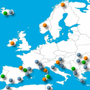 Overview Map for Offroad routes
here click

Short route description (Morocco M15 border road):
On a mostly rocky track near the Algerian border, we pass military posts, beautiful oases, and children selling fossils.
Track length: 117 km
| Important information about the symbols click here | ||||
 |
|
Route description |
| Attention, the tour can only be driven in the predefined direction, as the last border post only allows vehicles to pass in one direction. |
 |
 |
We leave the paved road and drive through several palm oases with small villages. Be careful, slow down here, as there are a few children running on the trails. Those out early in the morning will encounter many locals with their carts on their way to their palm gardens.
|
|
We leave the oases and cross a newly built paved road. A gravel track now winds its way toward the mountains. We reach our first checkpoint: a small hut, a military jeep, and two soldiers lounging in the sun. One of them asks us where we're going, and then we can continue. |
 |
 |
 |
|
We reach our first mountain pass, from where we have a fantastic view of the steppe and the vast expanse of land. We also encounter camel herds again and again. The track over the pass is a bit steep in one section, but it's still manageable. |
 |
 |
In the middle of a steppe, we see a few houses. A young boy is standing on the path, trying to sell stones and fossils. There are plenty of sellers in Morocco, but the atmosphere here is just right. The young seller haggles us over the price like a big shot, so we give in and buy the specimen we've chosen, hoping to bring it home safely. |
 |
Where: Route Length: Approx. 121 km Difficulty: |
 |
|
We continue through a vast steppe, where we encounter a large herd of goats. We continue on and reach our second mountain pass. Afterward, we reach an oasis with a military post, where we are checked and allowed to continue. From there, a track leads to Merzouga, which we continue for several more kilometers, but then we turn around and head west along the Algerian border. |
 |
 |
|
A mostly sandy track takes us along the border, where we reach a campsite in the middle, where we can inquire about the road's accessibility. After about 30 kilometers, we reach another border post that only allows us to pass in this direction. |
 |
Tour reports (content)
<-- back to overview Morocco
Shop List
| 0 Products | - | 0.00 EUR |
| Go to cart | ||
Onlineshop (EN)

We have 739 guests and no members online
- Articles View Hits
- 20763702